Puerto Vallarta location is its first treasure

By Paco Morás
July 15, 2021
If you look into Wikipedia, you will find that Puerto Vallarta’s coordinates are as follows: 20°40′N, 105°16′W. This should say something (or rather, a lot) to readers. But not everybody is able to understand at first sight the meaning of these numbers. And to tell you the truth, they may not be so useful if you are just willing to know what to expect from Puerto Vallarta’s location.
And what to expect we will tell you. 20°40’N means the distance to the Equator. This is a privileged parallel (its proper and correct name). It passes through Hawaii’s Big Island, Puerto Vallarta, and the Caribbean Sea, among other spots.
But what Puerto Vallarta’s location has to offer depends not only on this number. In a smaller scale it also enjoys features that provide it with a unique natural environment.
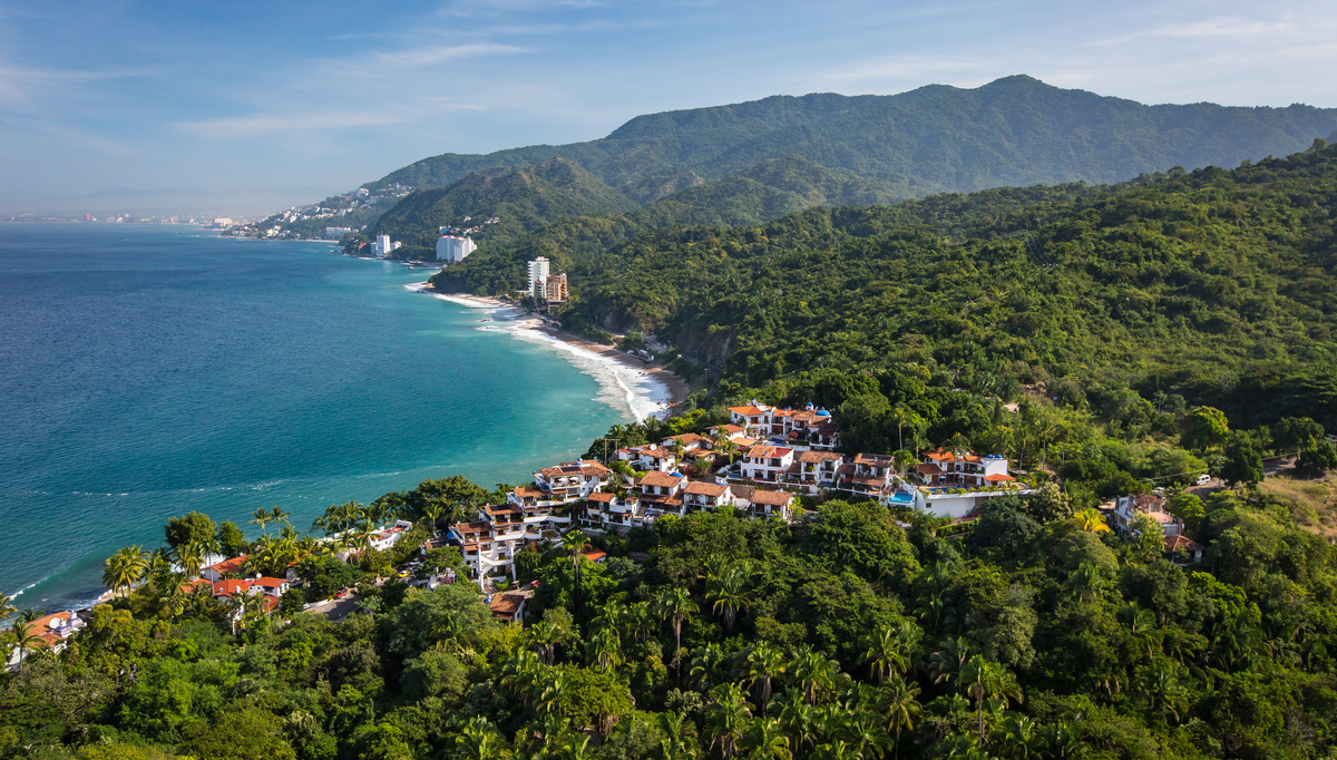
First, the Banderas Bay
First, let’s talk about Banderas Bay. The seventh largest bay in the world provides its coastal settlements with a protective water body. Its almost 3,000 feet (or about 900 meters) of depth help dissolve the forcefull currents running along the Pacific Ocean. Strong hurricanes have passed by without completely reaching its shores. That is another advantage of Puerto Vallarta’s location.
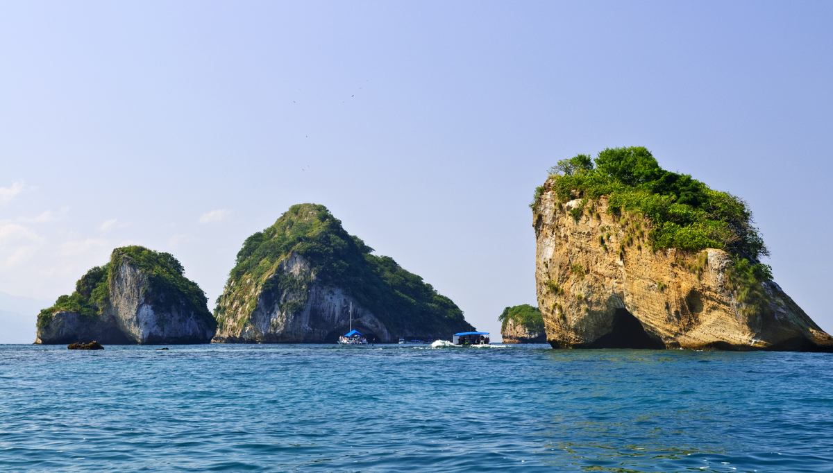
And this is before even mentioning the beauty of it. The Banderas Bay is a piece of natural art. The Marietas Islands near the northern cape and Los Arcos in the middle of the coastal arch have both been named Natural Protected Areas in order to preserve its unique ecosystems.
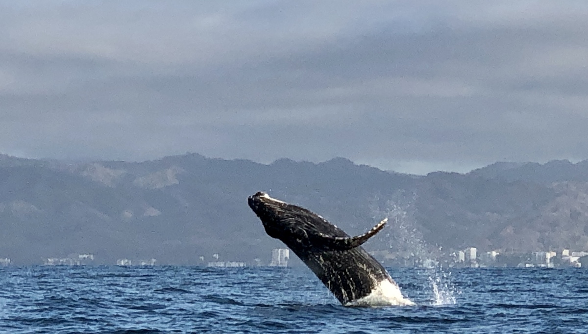
The bay is home to species such as marlin, swordfish, and giant tuna. However, the best known and most beloved are the humpback whales. They come every winter to mate and breed their calves, perpetuating the circle of life of which we are fortunate witnesses.
Puerto Vallarta’s location.
Now the rivers
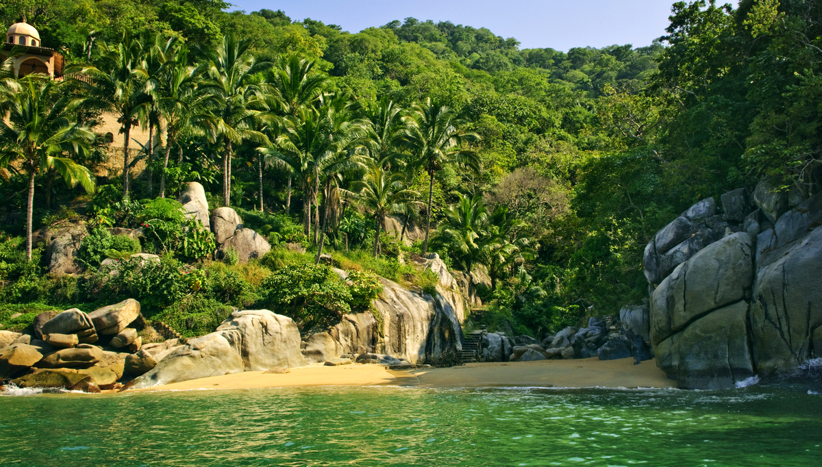
Feeding the bay, we can find a number of rivers. From North to South, the largest ones are Ameca, Pitillal, Cuale, Mismaloya, Los Horcones and Tomatlán. There are also several creeks which lose their water in the dry season. But in the rainy months, they run merrily into the bay, forming waterfalls on their way down from the mountains. All these currents are home to a great variety of flora and fauna feeding from their waters and rich banks. Just in case you were wondering if Puerto Vallarta’s location was really important!
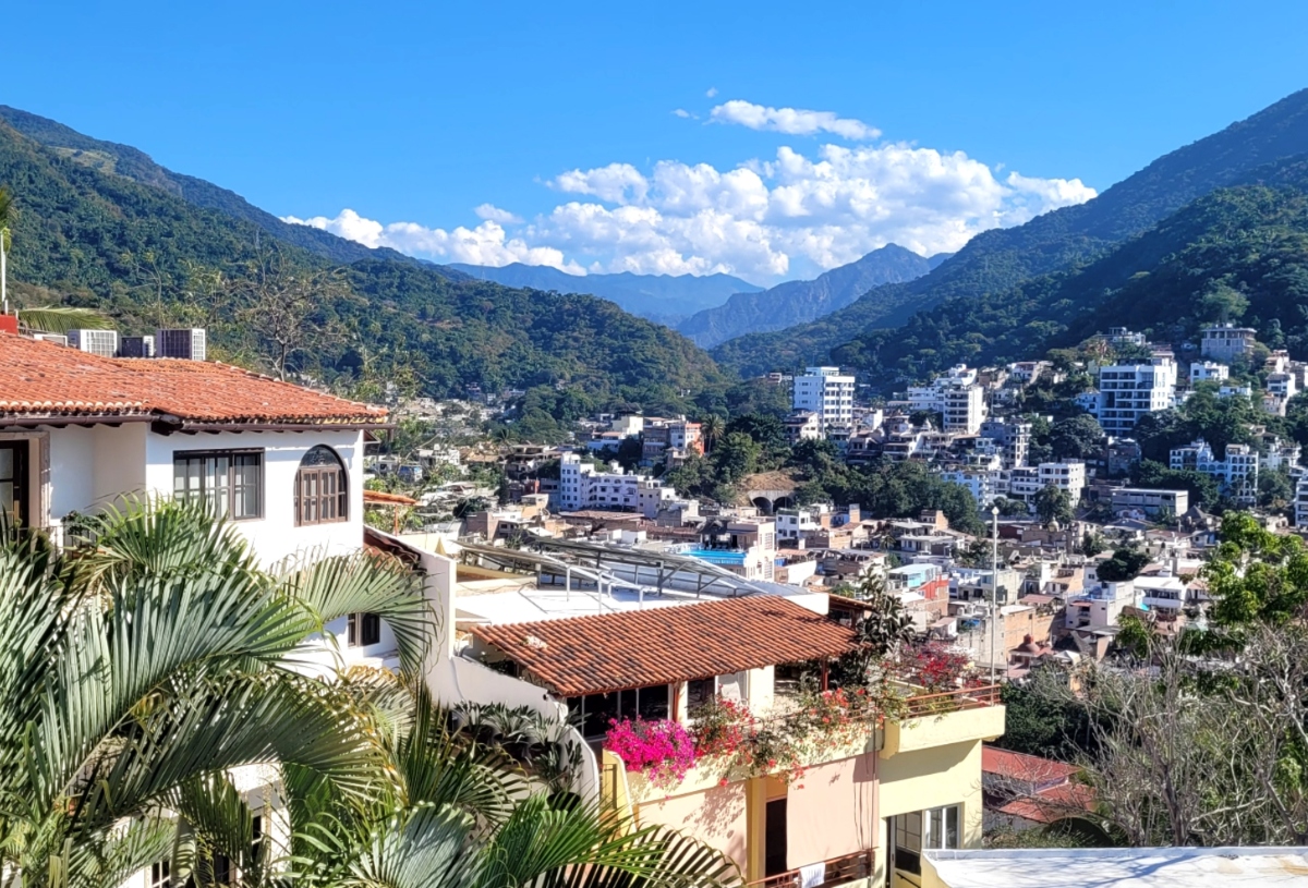
And the mountains!
And now we have mentioned the mountains. The beloved mountains of Puerto Vallarta! Part of the Sierra Madre Occidental, they reach the sea in the southern part of the bay. Northbound, they come in and out the shore. In the Puerto Vallarta downtown area, they leave just enough room to nestle a couple of streets. From that point on, the coastal plain starts widening, creating large and fertile prairies along the Ameca River.
As we said earlier, geographical coordinates only tell the “scientific” part of Puerto Vallarta’s location. Its richness is determined by much more than just its geographical location. All the features described above have happened to concur in a single spot to create an extraordinary place. Many of us rightfully call it “paradise”. And this paradise is inhabited by the other element of Puerto Vallarta’s allure: its people. But that is matter for another occasion.


------ADVERTISEMENT------
------ADVERTISEMENT------
------ADVERTISEMENT------
------ADVERTISEMENT------